
Best Hiking Trails Near Denver
Ten trails within about an hour of Denver, with distance and elevation figures pulled from Jefferson County Open Space, Colorado Parks & Wildlife, and the U.S. Fish & Wildlife Service rather than crowdsourced apps.
How this guide was built: Guidevio compiled it from Jefferson County Open Space park pages, Colorado Parks & Wildlife park and COTREX (Colorado Trail Explorer) pages, and U.S. Fish & Wildlife Service refuge pages. We did not hike these trails as part of building this guide, and nothing here is a review or a sponsored placement. Trail conditions, closures and even measured distances can change; always check the managing agency's own current alerts page before a hike. Links go to official agency pages and earn no commission.
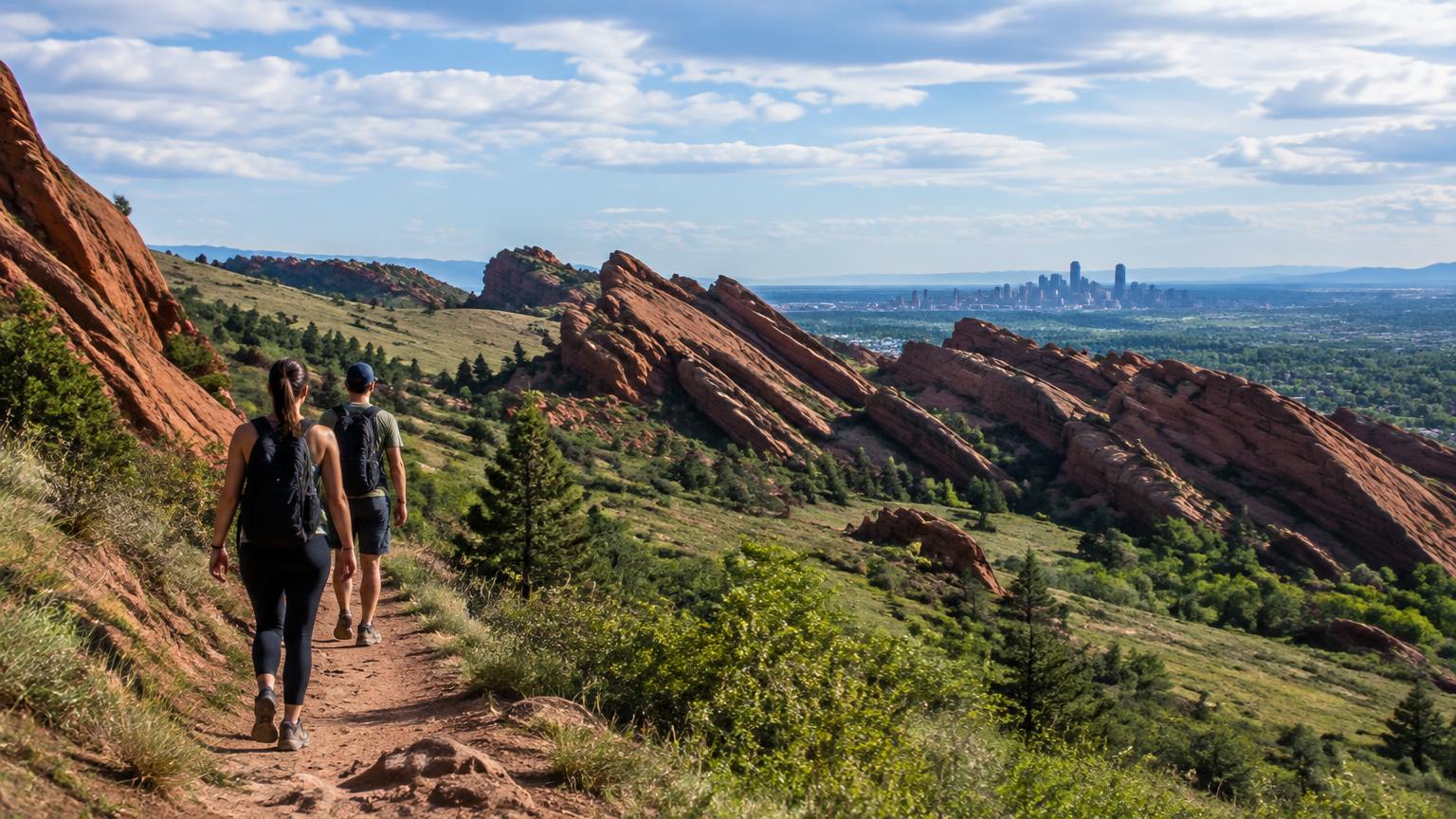
Denver's Front Range foothills hold dozens of well-maintained trail systems within an hour's drive, managed by a patchwork of agencies: Jefferson County Open Space, Colorado Parks & Wildlife state parks, and the U.S. Fish & Wildlife Service at Rocky Mountain Arsenal National Wildlife Refuge. This guide sticks to trails where the managing agency itself publishes a distance or elevation-gain figure, rather than relying on crowdsourced hiking apps, which frequently disagree with each other and with the agency that actually maintains the trail.
Trail distances vary more than you'd expect depending on the source. A trailhead's exact starting point, whether a loop or connector is included, and how a route is measured can shift a published figure by a mile or more. Where an agency figure was available, it is used and cited by name; where an agency did not publish an exact distance for a specific route, that is stated directly rather than filled in with a third-party number.
What was checked for each trail: distance and elevation gain from the managing agency's own park page, fact sheet, or the state's official COTREX trail database, and any designated-use rules (hiker-only days, dog and bike policies) as published by that same agency.
Who this guide is for
- Denver-area residents planning a weekday or weekend hike within about an hour's drive
- Visitors who want an agency-verified distance before committing to a trail
- Families looking for shorter, flatter options alongside longer climbs
- Hikers who want to know a trail's dog, bike and seasonal-closure rules before arriving
- Anyone comparing several Front Range trail systems at once
How we chose
- Selected trails managed by Jefferson County Open Space, Colorado Parks & Wildlife, or the U.S. Fish & Wildlife Service
- Pulled distance and elevation figures from each agency's own park page, fact sheet, or the state's COTREX trail database
- Where an agency did not publish a specific route's exact mileage, stated that directly rather than substituting a third-party hiking-app number
- Noted each trail's dog, bike and seasonal-closure rules as published by the managing agency
- Excluded any distance or elevation figure that could not be traced to an agency source
- This is desk research only: no trails were hiked in person to verify current conditions as part of this guide
Top 10 at a glance
Specifications as published by the manufacturer or the listing we consulted. Scroll sideways on a small screen.
| Pick | Best for | Managing agency | Distance | Elevation gain | Dogs / bikes | Price | Official site |
|---|---|---|---|---|---|---|---|
| 1. Lake Ladora Loop Trail | A short, wildlife-focused walk with an exact agency-published distance | U.S. Fish & Wildlife Service | 0.97 miles, per fws.gov | Not published; flat prairie terrain | No dogs; bikes not permitted on lake trails, per fws.gov | Free; no entrance fee | Visit |
| 2. Bear Creek Trail | A longer, creek-side day hike with a distance figure straight from the land manager | Jefferson County Open Space | 12.6 miles round trip, per jeffco.us | Not published by Jeffco for the full route | Leashed dogs yes; bikes on adjacent Rutabaga Ride only | Free; no entrance fee | Visit |
| 3. South Rim Trail | A short, agency-measured hike inside a state park with striking rock formations | Colorado Parks & Wildlife (Roxborough State Park) | 1.8 miles, per COTREX | 347 ft, per COTREX | Neither permitted, per CPW | Daily vehicle pass $10-$15, per cpw.state.co.us | Visit |
| 4. Chatfield Dam Trail | An easy, mostly paved walk or ride with clear agency accessibility information | Colorado Parks & Wildlife (Chatfield State Park) | 2.7 miles, per coloradostateparks.net | Minimal (easy-rated), per coloradostateparks.net | Leashed dogs and bikes both permitted | Daily vehicle pass $12-$17, per cpw.state.co.us | Visit |
| 5. Chatfield Perimeter Trail | Building a custom long loop around Chatfield Reservoir using the park's own connected trail network | Colorado Parks & Wildlife (Chatfield State Park) | Up to 26.0 miles of connected trail, per coloradostateparks.net | Moderate (~5,460 ft), per coloradostateparks.net | Leashed dogs and bikes both permitted | Daily vehicle pass $12-$17, per cpw.state.co.us | Visit |
| 6. Mount Galbraith Loop | A moderate summit loop with an exact county-published distance and elevation | Jefferson County Open Space | 1.6-mile summit loop, per jeffco.us | Summit at 7,260 ft, per jeffco.us | Leashed dogs yes; no bikes, hiker-only park | Free; no entrance fee | Visit |
| 7. Castle Trail | A challenging climb to a historic site with elevation gain confirmed by the land manager | Jefferson County Open Space | 3.9 miles, per COTREX | 2,000 ft, per jeffco.us | Leashed dogs and bikes both permitted, per COTREX | Free; no entrance fee | Visit |
| 8. Centennial Cone Loop | Experienced hikers who want a long, quieter loop without heavy foot traffic | Jefferson County Open Space | 12-mile main loop, per jeffco.us | Not published as a single figure by Jeffco | Alternating-use schedule; leashed dogs and bikes both permitted on designated days | Free; no entrance fee | Visit |
| 9. Matthews/Winters Park Trails | A park with an agency-published total trail mileage and multiple route options to mix and match | Jefferson County Open Space | 9.2 park trail miles total, per Jeffco's fact sheet; specific route mileage not itemized | Not published as a single park-wide figure | Dogs permitted except on Mt. Morrison trail; 0.8-mile bike-only Dakota Ridge South segment | Free; no entrance fee | Visit |
| 10. Mount Morrison (South Ridge) | Hikers who want a short, steep Front Range climb and are comfortable that the exact stats here aren't agency-confirmed | Jefferson County Open Space | Not published by Jeffco for this specific route | Not published by Jeffco for this specific route | Dogs prohibited; bikes and horses not permitted on this route | Free; no entrance fee | Visit |
The ten picks in detail
Lake Ladora Loop Trail
Rocky Mountain Arsenal National Wildlife Refuge
We only show official or licensed product photography. None is on file for this one yet — see the maker's page for photos.
Open product pageLake Ladora Loop Trail
USFWS's own trails page lists the Lake Ladora Loop Trail at 0.97 miles, one of the most precisely published distances of any trail in this guide
The U.S. Fish & Wildlife Service's own trails page lists the Lake Ladora Loop Trail at exactly 0.97 miles, one of more than 20 named, individually measured trails across the refuge's 20 miles of hiking paths.
Why it is on this list: Rocky Mountain Arsenal National Wildlife Refuge is the only federally managed site in this guide, and the U.S. Fish & Wildlife Service publishes exact, individually measured distances for every named trail on the refuge.
Key features
- 0.97-mile loop, per fws.gov's trails page
- Part of a 20-mile refuge trail network open year-round, per fws.gov
- Catch-and-release fishing permitted at Lake Ladora with a Colorado fishing license and refuge fee
- All trails on the refuge are accessible except Rattlesnake Hill Trail and portions of the Prairie and Havana Ponds Trails
- Distance: 0.97 miles, per fws.gov
- Elevation gain: Not published by USFWS; terrain is flat prairie
- Dogs: Not permitted (service animals only), per USFWS refuge rules
- Pros
- Exact distance published by USFWS itself, down to the hundredth of a mile
- Flat, easy loop around a lake with bison, bald eagle and prairie-dog habitat nearby
- No dogs permitted anywhere on the refuge, which keeps it calmer for wildlife-focused visits
- Cons
- No dogs allowed, per USFWS refuge rules, if you were hoping to bring one
- Boats, kayaks and other flotation devices are prohibited on refuge lakes
Before you buy: Check the refuge's alerts page before visiting; a detour is in effect via the Buckley Trail during a road-widening project near the refuge.
Bear Creek Trail
Lair o' the Bear Park
We only show official or licensed product photography. None is on file for this one yet — see the maker's page for photos.
Open product pageBear Creek Trail
Jeffco's own park page states the Bear Creek Trail offers "a 12.6-mile, round-trip journey... passing through three adjoining Denver Mountain Parks"
Jefferson County Open Space's own park page describes a 12.6-mile round trip on the Bear Creek Trail from Lair o' the Bear Park, passing through three adjoining Denver Mountain Parks.
Why it is on this list: Lair o' the Bear is one of the few Jeffco parks where the county's own page publishes a specific round-trip mileage for its signature trail, rather than a general park-acreage figure.
Key features
- 12.6-mile round trip to Panorama Point and back, per jeffco.us
- Trail crosses into Denver Mountain Parks' Pence Park, per Jeffco's regional trail-connections page
- Rutabaga Ride, a separate 3.5-mile bike-only trail, opened in the park in 2023
- Leashed dogs permitted
- Distance: 12.6 miles round trip, per jeffco.us
- Elevation gain: Not published by Jeffco for the full route
- Dogs: Leashed dogs permitted
- Pros
- 12.6-mile round-trip figure comes directly from Jeffco's own park page
- Runs alongside Bear Creek the entire way, with shade and fishing access
- Shorter out-and-back options are easy to build from the same trailhead
- Cons
- Crosses multiple jurisdictions beyond Jeffco Open Space, so rules can vary along the route, per jeffco.us
- Popular with mountain bikers on the adjacent Rutabaga Ride trail, so stay alert near that junction
Before you buy: Check jeffco.us for active closures; sections of Bear Creek Trail have had temporary closures for flood-damage repair.
South Rim Trail
Roxborough State Park
We only show official or licensed product photography. None is on file for this one yet — see the maker's page for photos.
Open product pageSouth Rim Trail
COTREX, the state's own trail database, lists the South Rim Trail at 1.8 miles with a 347-foot elevation range, managed by Roxborough State Park
COTREX, Colorado's official state trail database, lists the South Rim Trail within Roxborough State Park at 1.8 miles with 347 feet of elevation gain, managed directly by the state park.
Why it is on this list: Roxborough is a Colorado state park with figures published through the state's own trail database, and its red-rock geology stands out among the trails in this guide.
Key features
- 1.8 miles, elevation range 6,176-6,523 ft, per COTREX (trails.colorado.gov)
- Roxborough's overall trail system totals about 15 miles across 8 trails, per CPW
- Pedestrian traffic only; no dogs, bikes or horses permitted, per CPW
- Connects to Douglas County Open Space and Pike National Forest trails
- Distance: 1.8 miles, per COTREX (trails.colorado.gov)
- Elevation gain: 347 ft, per COTREX
- Dogs: Not permitted, per CPW
- Pros
- Distance and elevation gain both published through the state's own COTREX trail database
- Sits inside a Colorado Natural Area and National Natural Landmark with red-rock scenery
- Can be combined with other Roxborough trails for a longer outing
- Cons
- No dogs or bikes permitted anywhere in Roxborough State Park, per Colorado Parks & Wildlife
- Requires a Colorado state parks pass or daily vehicle fee
Before you buy: CPW's own trail page notes hikers should watch for rattlesnakes and poison ivy and stay on the marked trail.
Chatfield Dam Trail
Chatfield State Park
We only show official or licensed product photography. None is on file for this one yet — see the maker's page for photos.
Open product pageChatfield Dam Trail
Chatfield State Park's own trail-descriptions page lists the Dam Trail as ADA accessible, with 2.4 of its 2.7 total miles paved
Chatfield State Park's own trail-description page lists the Chatfield Dam Trail at 2.7 miles total, mostly paved (2.4 of 2.7 miles), and marked ADA accessible.
Why it is on this list: Chatfield State Park publishes exact pavement and accessibility details for this specific trail, not just a park-wide total, which is unusually precise among the agency sources checked for this guide.
Key features
- 2.7 miles total, 2.4 miles paved and 0.3 miles unpaved, per coloradostateparks.net
- Elevation approximately 5,500 ft, rated easy difficulty, per the park's trail page
- Crosses the entirety of the Chatfield dam with foothill views
- Connects to the Chatfield Perimeter Trail for a longer route
- Distance: 2.7 miles, per coloradostateparks.net
- Elevation gain: Minimal; rated easy at about 5,500 ft, per coloradostateparks.net
- Dogs: Leashed dogs permitted
- Pros
- Distance and pavement breakdown both published on the park's own trail-descriptions page
- Fully paved except for 0.3 miles, making it one of the more accessible trails in this guide
- Connects to the larger Chatfield internal trail network for a longer outing
- Cons
- No shade along the dam crossing
- Requires a Colorado state parks pass or daily vehicle fee
Before you buy: The park's own page notes the trail is open to foot and bike traffic, with leashed dogs also permitted.
Chatfield Perimeter Trail
Chatfield State Park
We only show official or licensed product photography. None is on file for this one yet — see the maker's page for photos.
Open product pageChatfield Perimeter Trail
Chatfield's own trail page states the park's internal trail network totals 26.0 miles, with 16 miles non-paved and 10 miles paved
Chatfield State Park's own trail page describes an internal trail network totaling 26.0 miles around the reservoir, combining 16 miles of natural surface and 10 miles of paved trail, for hikers who want a longer loop than the Dam Trail alone.
Why it is on this list: Chatfield publishes a specific, itemized trail-mileage breakdown for the whole reservoir loop system, which is more detail than most agency pages in this guide provide.
Key features
- 26.0 miles total internal trail network, per coloradostateparks.net
- Elevation approximately 5,460 ft, rated moderate difficulty, per the park's page
- Connects to Mary Carter Greenway, Centennial Trail, Columbine Trail, Highline Canal Trail and Waterton Canyon/Colorado Trail
- Horse trailer parking and corrals available on the park's west side
- Distance: Up to 26.0 miles of connected trail, per coloradostateparks.net
- Elevation gain: Moderate, at about 5,460 ft, per the park's trail page
- Dogs: Leashed dogs permitted
- Pros
- Total mileage for the internal trail network is published directly by the park
- Connects to the Mary Carter Greenway, Colorado Trail and Waterton Canyon trailhead
- Mix of paved and natural surface gives options for different trail preferences
- Cons
- The 26.0-mile figure covers the whole internal network, not one single marked "Perimeter Trail" loop, so plan a specific route on the park's map before heading out
- Requires a Colorado state parks pass or daily vehicle fee
Before you buy: Pick up a trail map at the park entrance or use the state's COTREX site to plan a specific perimeter route, since the published figure covers the full network rather than one single loop.
Mount Galbraith Loop
Mount Galbraith Park
We only show official or licensed product photography. None is on file for this one yet — see the maker's page for photos.
Open product pageMount Galbraith Loop
Jeffco's own park page states "the Mt. Galbraith Loop circles 1.6 miles around the top of the 7,260-foot peak"
Jefferson County Open Space's own park page states the Mt. Galbraith Loop circles 1.6 miles around the top of the 7,260-foot peak, one of the more precise county-published loop distances in this guide.
Why it is on this list: Mount Galbraith is the clearest example in this guide of a Jeffco park page publishing a specific named loop's distance and its summit elevation together, rather than only a park-wide trail total.
Key features
- 1.6-mile loop around the 7,260-ft summit, per jeffco.us
- Nearly 5 miles of hiker-only trails across the park, per jeffco.us
- Acquired by Jefferson County Open Space beginning in 1995, per planjeffco.org
- Leashed dogs permitted; hiker-only, no bikes
- Distance (summit loop): 1.6 miles, per jeffco.us
- Summit elevation: 7,260 ft, per jeffco.us
- Dogs: Leashed dogs permitted; hiker-only park
- Pros
- 1.6-mile summit-loop distance and 7,260-ft peak elevation both published directly by Jeffco
- Hiker-only park, which keeps the narrow, rocky trails free of bike traffic
- Views of Golden, the plains and the Continental Divide from the upper loop
- Cons
- The park's other approach trails add several more miles beyond the 1.6-mile summit loop itself
- Rocky, steep terrain in places; not a flat walk
Before you buy: The 1.6-mile figure covers the summit loop itself; reaching it from the trailhead and back adds additional distance depending on the approach used.
Castle Trail
Mount Falcon Park
We only show official or licensed product photography. None is on file for this one yet — see the maker's page for photos.
Open product pageCastle Trail
Jeffco's own park page states "the 2,000-foot elevation gain of the Castle Trail... provides a vigorous workout"
Jefferson County Open Space's own park page states the Castle Trail has a 2,000-foot elevation gain, and the state's COTREX database lists its total length at 3.9 miles, leading to the ruins of John Brisben Walker's mountaintop home.
Why it is on this list: Mount Falcon's Castle Trail has both an elevation-gain figure from Jeffco's own park page and a total-length figure from the state's official COTREX database, giving it two independent agency-sourced numbers rather than one.
Key features
- 2,000-ft elevation gain, per jeffco.us
- 3.9 total miles, per COTREX (trails.colorado.gov)
- Leads to the ruins of John Brisben Walker's early-1900s stone mansion
- Multi-use: open to hiking, leashed dogs, bikes and horses, per COTREX
- Elevation gain: 2,000 ft, per jeffco.us
- Distance: 3.9 miles total, per COTREX
- Dogs: Leashed dogs permitted
- Pros
- 2,000-ft elevation-gain figure comes directly from Jeffco's own park page
- 3.9-mile total distance is published through the state's COTREX trail database
- Historic ruins and a lookout tower along the route
- Cons
- A steep, sustained climb; Jeffco's own page calls it a vigorous workout
- Multi-use trail shared with bikes and horses, per COTREX
Before you buy: Jeffco's own alerts page has noted seasonal closures on nearby Tiers of Zion; check current conditions before a visit.
Centennial Cone Loop
Centennial Cone Park
We only show official or licensed product photography. None is on file for this one yet — see the maker's page for photos.
Open product pageCentennial Cone Loop
Jeffco's own park page describes Centennial Cone as offering "a near-backcountry experience, with a 12-mile trail loop that challenges stamina"
Jefferson County Open Space's own park page describes a 12-mile trail loop through near-backcountry terrain between Clear Creek and Golden Gate Canyons, with wildlife viewing and alternating hiker/bike weekend access.
Why it is on this list: Centennial Cone is one of the largest Jeffco parks with a specific loop distance published on the county's own page, and its alternating-use rule is a level of published trail-management detail not found at most other parks in this guide.
Key features
- 12-mile main loop, per jeffco.us
- 3,672 acres and 16.2 total trail miles across the park, per Jeffco's park map
- Weekend alternating use: hiking/horseback odd dates, biking even dates, per jeffco.us
- Closed to public access December-January except for permitted CPW-licensed hunters
- Distance: 12-mile main loop, per jeffco.us
- Park trail total: 16.2 miles across 3,672 acres, per Jeffco's park map
- Dogs: Leashed dogs permitted on non-restricted days
- Pros
- 12-mile loop distance published directly on Jeffco's own park page
- Alternating-use schedule keeps hikers and bikers from sharing the trail on the same weekend day
- Elk and other wildlife sightings common, per Jeffco and the Colorado Mountain Club
- Cons
- Park closes seasonally (December-January for hunting, and part of spring for elk calving), per Jeffco
- 12 miles is a long commitment compared with most other trails in this guide
Before you buy: Jeffco's own site notes the park is closed February through mid-June in parts for elk calving; check current alerts before planning a visit.
Matthews/Winters Park Trails
Matthews/Winters Park
We only show official or licensed product photography. None is on file for this one yet — see the maker's page for photos.
Open product pageMatthews/Winters Park Trails
Jeffco's own Dakota Ridge Trail Extension fact sheet lists Matthews/Winters Park at 2,474 acres with 9.2 trail miles as of its original 1973 establishment
Jefferson County Open Space's own fact sheet for the Dakota Ridge Trail Extension lists Matthews/Winters Park at 2,474 acres and 9.2 trail miles, with individual named trails like Dakota Ridge providing foothill and Red Rocks views.
Why it is on this list: Matthews/Winters Park has a park-wide acreage and mileage total published in an official Jeffco planning document, making it a defensible agency figure even though the county does not publish exact mileage for every individual named trail inside the park.
Key features
- 2,474 acres and 9.2 original trail miles, per Jeffco's Dakota Ridge Trail Extension fact sheet
- 0.8-mile Dakota Ridge South Trail segment is designated mountain-bike only, per jeffco.us
- Free Westracks Shuttle connects to the trailhead on summer weekends and holidays
- Dogs prohibited specifically on the Mt. Morrison trail within the park
- Park acreage: 2,474 acres, per Jeffco's fact sheet
- Park trail total: 9.2 miles (original network), per Jeffco's fact sheet
- Dogs: Permitted park-wide except on the Mt. Morrison trail
- Pros
- Total park acreage (2,474) and trail mileage (9.2 miles) published directly by Jeffco
- Connects to Red Rocks Park and Dinosaur Ridge
- Free seasonal Westracks shuttle connects to the trailhead on weekends and holidays
- Cons
- Jeffco's own page does not break out exact mileage for individual named routes like the Dakota Ridge Trail itself
- Dogs are prohibited specifically on the Mt. Morrison trail within the park, per jeffco.us
Before you buy: For a specific route's exact mileage within the park, check the current trail map at jeffco.us, since the 9.2-mile figure describes the park's original trail network rather than every individual named route today.
Mount Morrison (South Ridge)
Matthews/Winters Park
We only show official or licensed product photography. None is on file for this one yet — see the maker's page for photos.
Open product pageMount Morrison (South Ridge)
Jeffco's own park page confirms this trail is managed within Matthews/Winters Park, including a specific rule that dogs are prohibited on it
Jefferson County Open Space's own park page confirms Mount Morrison is within Matthews/Winters Park and that dogs are prohibited on this trail, but the county's own pages checked for this guide did not publish an exact distance or elevation-gain figure for the South Ridge route itself.
Why it is on this list: Mount Morrison is included because Jeffco does regulate and recognize this specific route, but its distance and elevation figures are stated here as not published rather than filled in with a third-party hiking app number, per this guide's sourcing rule.
Key features
- Located within the 2,474-acre Matthews/Winters Park, per jeffco.us
- Only the South Ridge route from Red Rocks Park's Titans Road entrance is sanctioned by the county
- Jeffco completed erosion-control restoration work along the trail starting in 2022, per the Colorado Mountain Club
- Dogs are prohibited on this specific trail, per jeffco.us
- Distance: Not published by Jeffco for this specific route
- Elevation gain: Not published by Jeffco for this specific route
- Dogs: Prohibited on this trail, per jeffco.us
- Pros
- Jeffco's own page explicitly names and regulates this trail (dogs prohibited), confirming it is an agency-recognized route
- Direct views over Red Rocks Amphitheatre and the Denver skyline
- Jeffco has performed erosion-control restoration work on the route, per the Colorado Mountain Club
- Cons
- No agency-published distance or elevation-gain figure was found for this specific route as of this research
- Steep, loose, unofficial-style tread; Jeffco only sanctions the South Ridge approach
Before you buy: Distance and elevation gain for this route are not published on the Jeffco pages checked for this guide; confirm current trail information directly with Jefferson County Open Space before relying on a third-party figure.
How the top picks actually differ
Not every agency publishes distance the same way
Jefferson County Open Space typically publishes a single headline figure per trail (a loop distance, a round-trip mileage, or an elevation gain), while the state's COTREX database independently measures total trail length and elevation range for many of the same routes. Where both existed, this guide cites both, and where a route's exact mileage wasn't published anywhere agency-side (Mount Morrison), that gap is stated rather than filled with a hiking-app number.
Rules vary as much as terrain
Dogs are welcome on most Jeffco trails in this guide but banned outright at Rocky Mountain Arsenal National Wildlife Refuge and Roxborough State Park, and specifically prohibited on the Mount Morrison trail within Matthews/Winters Park. Bikes are restricted to designated days at Centennial Cone and to a short bike-only segment at Matthews/Winters. Check the specific trail's rules, not just the park's general policy, before a visit.
Who should choose what
you want the shortest, flattest agency-measured trail
Lake Ladora Loop Trail at Rocky Mountain Arsenal
you want a long day hike with a confirmed distance
Bear Creek Trail at Lair o' the Bear (12.6 miles round trip)
you want a paved, ADA-accessible option
Chatfield Dam Trail
you want a steep climb to a historic site
Castle Trail at Mount Falcon Park
you want a quiet, near-backcountry loop
Centennial Cone Loop
Common questions
- Why do trail distances here sometimes differ from what a hiking app shows?
- This guide only uses distances published by the managing agency itself — Jefferson County Open Space, Colorado Parks & Wildlife/COTREX, or the U.S. Fish & Wildlife Service. Crowdsourced hiking apps often measure a slightly different start point or route variation, which is why their numbers can differ from the agency's own figure.
- Why does Mount Morrison list 'not published' for distance and elevation?
- Jefferson County Open Space's own pages confirm and regulate this specific trail (including a dog prohibition) but did not publish an exact distance or elevation-gain figure for it on the pages checked during this research, so this guide states that gap directly rather than substituting a third-party number.
- Are dogs allowed on all of these trails?
- No. Dogs are not permitted at Rocky Mountain Arsenal National Wildlife Refuge or Roxborough State Park, and are specifically prohibited on the Mount Morrison trail within Matthews/Winters Park. Most other trails in this guide allow leashed dogs.
- Do any of these trails require an entrance fee?
- Roxborough State Park and Chatfield State Park both require a Colorado state parks daily vehicle pass or annual pass, per Colorado Parks & Wildlife. The Jeffco Open Space parks and the wildlife refuge in this guide are free.
- Which trail has the longest single agency-published distance?
- Bear Creek Trail at Lair o' the Bear has the longest single confirmed distance in this guide, at 12.6 miles round trip per Jefferson County Open Space's own park page.
- Can I bring a bike on these trails?
- It depends on the trail. Bikes are allowed on the Castle Trail at Mount Falcon and on the Chatfield trails, restricted to alternating days at Centennial Cone, limited to a short designated segment at Matthews/Winters, and prohibited at Roxborough State Park and the wildlife refuge's lake trails.
Sources consulted
Official product pages, specification sheets and retailer listings used to compile this guide.
- https://www.fws.gov/refuge/rocky-mountain-arsenal/visit-us/trails
- https://www.jeffco.us/1254/Lair-o-the-Bear-Park
- https://trails.colorado.gov/trails/south-rim-6286
- https://cpw.state.co.us/state-parks/roxborough-state-park/roxborough-state-park-activities-trails
- https://coloradostateparks.net/parks/chatfield/trails/
- https://www.jeffco.us/1335/Mount-Galbraith-Park
- https://www.jeffco.us/1332/Mount-Falcon-Park
- https://trails.colorado.gov/trails/castle-18636
- https://www.jeffco.us/1192/Centennial-Cone-Park
- https://www.jeffco.us/1292/Matthews-Winter-Park
- https://www.jeffco.us/DocumentCenter/View/9196/Dakota-Ridge-Trail-Extension_FactSheet
Related guides
The Best Hiking Boots of 2026
Ten current hiking boots and shoes compared by weight, waterproofing, upper material and sole, covering budget mids, lightweight trail shoes, leather backpacking boots and premium mountain models.
Best Hiking Day Packs 2026
Ten currently sold hiking day packs compared on published capacity, weight, price and features, from ultralight minimalist packs to fully suspended all-day haulers.
Best Trekking Poles of 2026: Top 10 Picks for Hiking, Backpacking and Fastpacking
Ten currently sold trekking poles compared on published materials, weight and price, spanning budget aluminum poles, ultralight carbon folding poles and mountaineering-grade options from multiple brands.
Best Hiking Socks of 2026: Top 10 Picks for Day Hikes, Thru-Hikes and Cold Trails
Ten currently sold hiking socks compared on published cushioning, fiber content and price, from merino wool crews to five-toe trail socks and heavyweight winter options.
Best Colorado Ski Resorts for Beginners
Ten Colorado resorts compared on the beginner-terrain percentage, dedicated learning areas and base elevation each resort publishes on its own site — built for first-timers and early-progression skiers, not experts.
Best Winter Hiking Boots (2026): Insulated & Waterproof, Men's and Women's
Ten currently sold, insulated, waterproof winter hiking boots for men and women, spanning budget to premium, verified on each brand's official US website.
One useful email a week
New guides, revisions to existing ones with a note on what changed and why, and price moves worth knowing about. One email a week, unsubscribe anytime.