
Best Beach Towns in the US
Ten well-known US beach towns compared on facts pulled from each town's own tourism board or municipal site — beach length, boardwalk length, founding history and more.
How this guide was built: Guidevio compiled it from each town's own tourism board, chamber of commerce or municipal government website. We did not visit these towns to build this guide, and nothing here is a review, a ranking based on personal experience, or a sponsored placement. Where a town's own site mentions a third-party award or accolade, it is presented only as something the tourism board notes, not as Guidevio's own claim. Figures such as beach length, boardwalk length and population can change; always check the town's own site before a trip. Links go to official tourism or municipal pages and earn no commission today; if that changes, it will be disclosed here.
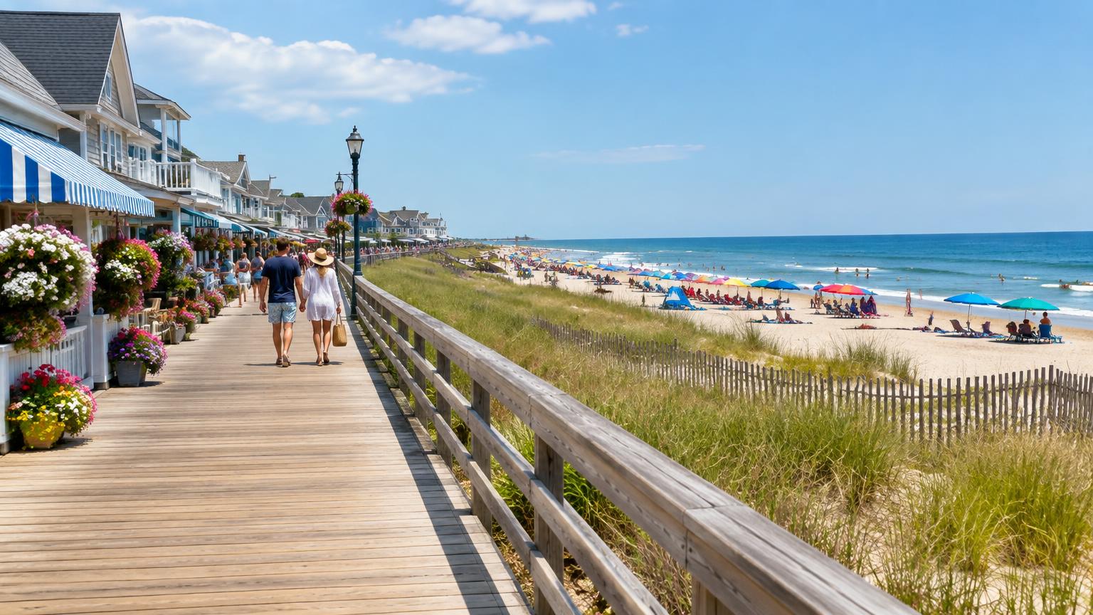
The US Atlantic and Gulf coasts, plus a stretch of Southern California, are home to dozens of well-known beach towns, each with its own history, shoreline and character. This guide covers ten towns that publish enough information on their own official tourism board or municipal site to compare directly, from the length of a boardwalk to the width of a barrier island.
Every fact below is pulled from a town or regional tourism board's own website. Where a figure such as founding date, average visitor count or a specific mileage was not published on the official pages checked, this guide says 'Not published' instead of estimating it or borrowing a number from a third-party travel article.
This is not a ranking of which beach is 'best.' It is a side-by-side reference for choosing among ten established beach towns based on documented facts: coastline length, walkability, historic character and how each town describes itself to visitors.
Who this guide is for
- Travelers comparing East Coast, Gulf Coast and West Coast beach towns before booking
- Families weighing boardwalk-town amenities against quieter barrier-island stays
- History-minded travelers interested in a town's documented founding and landmark status
- Anyone who wants facts sourced from official tourism sites rather than review aggregators
- Road-trippers planning a coastal itinerary and comparing drive times or access
How we chose
- Selected ten widely known US beach towns spanning the Atlantic, Gulf and Pacific coasts
- Pulled every factual claim from each town's own tourism board, chamber of commerce or municipal government site
- Excluded any third-party ranking, review score or media 'best of' claim from the comparison table and specs
- Where a third party's award or recognition is mentioned, it is framed only as something the tourism board itself notes, not as Guidevio's own assessment
- Wrote 'Not published' anywhere an official site did not state a specific figure, rather than estimating or sourcing it from travel media
- This is desk research only: Guidevio did not visit these towns to verify current conditions for this guide
Top 10 at a glance
Specifications as published by the manufacturer or the listing we consulted. Scroll sideways on a small screen.
| Pick | Best for | Coastline / beach length | Known for | Access | Price | Official site |
|---|---|---|---|---|---|---|
| 1. Myrtle Beach | Travelers who want a boardwalk-centered beach town with extensive dining, golf and family attractions | 60 miles (Grand Strand), per visitmyrtlebeach.com | Boardwalk, golf, family entertainment | Not published as a specific drive-time table on the pages checked | No admission fee; the beach and boardwalk are open to the public | Visit |
| 2. Virginia Beach | Visitors who want a long boardwalk plus a choice between ocean and bay swimming | 38-plus miles citywide; 3-mile Boardwalk | Oceanfront district, surf culture, bay-and-ocean access | Not published as a specific mileage/drive-time figure on the pages checked; cited as about an hour from Richmond | No admission fee; the beach and Boardwalk are open to the public | Visit |
| 3. Outer Banks | Travelers who want long, less-developed beaches and historic sites over a concentrated boardwalk scene | 100-plus miles across the barrier islands | Wright Brothers history, Cape Hatteras National Seashore, low-rise villages | Not published as a single drive-time figure on the pages checked | No general admission fee; individual attractions such as Cape Hatteras National Seashore may have separate rules | Visit |
| 4. Pensacola Beach | Gulf Coast travelers who want a specific published drive-time table and a mix of commercial core plus quiet park beaches | 18 miles of Santa Rosa Island beach | Sugar-white sand, Fort Pickens, Gulf fishing | About 20 minutes from Pensacola International Airport, per pensacolabeach.com | No general admission fee for the beach; Fort Pickens entry fees are set by the National Park Service | Visit |
| 5. Cape May | Travelers who want documented historic architecture alongside a traditional New Jersey shore beach | Not published on the official pages checked | Victorian architecture, National Historic Landmark status, birdwatching | Not published on the official pages checked | Beach tags/fees may apply seasonally; check capemaycity.com for current beach-tag rules | Visit |
| 6. Ocean City | Visitors who want a specific, compact, long-established boardwalk with clearly published town rules | 10 miles of free public beach; 2.9-mile Boardwalk | Long-running boardwalk, amusements, family dining | Not published as a specific regional drive-time figure on the pages checked | No admission fee; the beach and Boardwalk are free and open to the public | Visit |
| 7. Nantucket | Travelers who want a preserved, less-developed island beach experience reached by ferry or air | 82 miles of coastline; island 14 by 3.5 miles | Conservation land, historic whaling heritage, ferry-only access | About 1 hour by high-speed ferry or about 2 hours 15 minutes by car ferry from Hyannis, per the town site | No general island admission fee; individual beach parking and ferry fares vary | Visit |
| 8. Hilton Head Island | Cyclists, families and golfers who want a wide, long beach plus an extensive path network | 12 miles of Atlantic beach | Golf, biking, sea turtle nesting season | Not published as a specific drive-time figure on the pages checked; served by an on-island airport and nearby Savannah airport | No admission fee; the beach is free and open to the public | Visit |
| 9. Destin | Travelers interested in a documented Gulf Coast fishing-village history alongside beach access | Not published on the official pages checked | Fishing history, emerald water, artificial reef system | Not published on the official pages checked | No general admission fee; the beach is open to the public | Visit |
| 10. Santa Barbara | Travelers who want a Pacific Coast beach town with a mild climate and nearby mountain scenery | Not published as a single citywide figure on the pages checked | Mediterranean climate, surfing, coastal bike path | Not published on the official pages checked | No admission fee; city beaches are free and open to the public | Visit |
The ten picks in detail
Myrtle Beach
South Carolina
We only show official or licensed product photography. None is on file for this one yet — see the maker's page for photos.
Open product pageMyrtle Beach
60 miles of coastline across 14 coastal communities collectively known as the Grand Strand, per the official Myrtle Beach Area Fact Sheet
Myrtle Beach anchors the Grand Strand, a 60-mile stretch of South Carolina coastline made up of 14 communities, per its own tourism board's fact sheet.
Why it is on this list: Myrtle Beach publishes some of the most specific regional facts of any town in this guide, including coastline length, accommodation counts and visitor volume.
Key features
- Over 17 million visitors annually, per the tourism board
- Approximately 2,000 full-service restaurants area-wide
- 90-plus championship golf courses, per visitmyrtlebeach.com
- Mild average annual temperature of 73°F with about 215 sunny days, per the tourism board
- Coastline length: 60 miles (Grand Strand)
- Communities: 14
- Annual visitors: Over 17 million, per the tourism board
- Pros
- 60 miles of coastline across 14 connected communities, per visitmyrtlebeach.com
- Iconic Myrtle Beach Boardwalk in the downtown core
- Roughly 425 hotels and 157,000 accommodation units, per the tourism board's fact sheet
- Cons
- A large, spread-out destination; the 'Myrtle Beach area' covers far more than the city itself
- Peak-season crowding is common at central boardwalk beaches
Before you buy: The tourism board's figures describe the wider Grand Strand area, not the city of Myrtle Beach alone; check which community you're booking within.
Virginia Beach
Virginia
We only show official or licensed product photography. None is on file for this one yet — see the maker's page for photos.
Open product pageVirginia Beach
The Oceanfront Beach is described by the tourism board as part of 'the Atlantic's longest stretch of pleasure beach,' at roughly 35 miles
Virginia Beach's own tourism site describes 38-plus miles of coastline where the Chesapeake Bay meets the Atlantic, with a three-mile Boardwalk running along the Oceanfront district.
Why it is on this list: Virginia Beach's own site publishes a specific coastline mileage and Boardwalk length, along with named beach districts, making it easy to compare factually.
Key features
- Grommet Island Park, an accessible oceanfront playground, per the tourism site
- City-operated municipal parking lots and garages at the Oceanfront
- Live outdoor entertainment at beachfront stages in summer, per visitvirginiabeach.com
- Total coastline: 38-plus miles, per the tourism board
- Boardwalk length: About 3 miles (2nd to 40th Streets)
- Oceanfront Beach: Described as roughly 35 miles long by the tourism board
- Pros
- 38-plus miles of coastline, per visitvirginiabeach.com
- Three-mile Boardwalk with a dedicated bike lane from 2nd to 40th Streets
- Both bay-side (Chesapeake Bay) and ocean-side beach options
- Cons
- The Oceanfront district is the busiest section; quieter bay beaches require traveling further within the city
- Parking at the Oceanfront is paid outside of walking distance from lodging, per the tourism site
Before you buy: The tourism site notes alcohol, marijuana and illegal drugs are not allowed on the public beaches; check the Beach Rules page before a visit.
Outer Banks
North Carolina
We only show official or licensed product photography. None is on file for this one yet — see the maker's page for photos.
Open product pageOuter Banks
Dare County covers 800 square miles, with 409 square miles of water, per the Outer Banks Visitors Bureau
The Outer Banks tourism board describes over 100 miles of shoreline along North Carolina's barrier islands, with Dare County alone covering 800 square miles, per its own site.
Why it is on this list: The Outer Banks publishes an unusually detailed set of geographic and historical facts on its own tourism site, from acreage to first-flight history.
Key features
- Jockey's Ridge State Park has the highest sand dune on the East Coast, over 90 feet, per the tourism board
- Site of the Wright brothers' first powered flight, near Kitty Hawk, per outerbanks.org
- 14 towns and villages across the barrier islands, per the tourism board
- Home to the Lost Colony outdoor drama on Roanoke Island
- Shoreline length: 100-plus miles, per the tourism board
- Dare County area: 800 square miles (391 land / 409 water)
- Towns/villages: 14
- Pros
- 100-plus miles of shoreline across the barrier islands, per outerbanks.org
- No cities on the Outer Banks; low-rise seaside villages instead, per the tourism board
- Cape Hatteras National Seashore, the first national seashore established by the federal government, per the tourism board
- Cons
- Spread across many separate towns and villages, so trip planning requires choosing a specific area
- N.C. Highway 12, the main coastal road, can close during storms, per the tourism board's own travel alerts
Before you buy: Check outerbanks.org and DriveNC.gov for current road conditions on N.C. Highway 12 before a Hatteras Island trip, since storm closures are common.
Pensacola Beach
Florida
We only show official or licensed product photography. None is on file for this one yet — see the maker's page for photos.
Open product pagePensacola Beach
The tourism board notes Pensacola Beach has been ranked among Trip Advisor's top beaches in the US and worldwide
Pensacola Beach sits on Santa Rosa Island, with its official tourism site citing 18 miles of what it calls 'sugar white' beaches and a historic fort administered by the National Park Service.
Why it is on this list: Pensacola Beach's official site publishes specific mileage, average temperatures and a drive-time table, giving unusually concrete comparison data.
Key features
- Footprints in the Sand Eco Trail covering local sea turtle and shoreline ecology, per the tourism site
- Pensacola Beach Pier for fishing and walking
- About a 20-minute drive from Pensacola International Airport, per pensacolabeach.com
- Average of 343 sunny days per year, per visitpensacolabeach.com
- Beach length: 18 miles, per the tourism board
- Average water temperature: 72°F, per the tourism board
- Sunny days per year: 343, per the tourism board
- Pros
- 18 miles of beach along Santa Rosa Island, per visitpensacolabeach.com
- Fort Pickens, a pre-Civil War fort administered by the National Park Service, within an 8-mile stretch of the island
- Published drive-time table from the town's own site for common regional trips
- Cons
- The commercial core sits within a compact stretch of the island, with quieter park areas at either end
- Specific founding-date and population figures were not published on the pages checked
Before you buy: The tourism board notes this reflects TripAdvisor's own rankings, not an assessment made by Guidevio.
Cape May
New Jersey
We only show official or licensed product photography. None is on file for this one yet — see the maker's page for photos.
Open product pageCape May
Cape May's own city site calls it 'The Nation's Oldest Seashore Resort'
Cape May's official city site describes it as a National Historic Landmark district with the second-largest collection of Victorian buildings in the country, after San Francisco.
Why it is on this list: Cape May is one of the few towns in this guide with a documented federal historic designation stated directly on its municipal site.
Key features
- Named for Dutch explorer Cornelius Jacobsen Mey, who charted the area in the early 1600s, per capemaycity.com
- More than 400 recorded bird species, per the city's official site
- Cape May Diamonds: quartz pebbles that wash down the Delaware River, noted on the official city site
- Began hosting Philadelphia-area vacationers in the mid-18th century, per capemaycity.com
- Historic designation: National Historic Landmark district, designated 1976
- Victorian houses: Second-largest collection in the US, per the city site
- Beach length: Not published on the capemaycity.com pages checked
- Pros
- Designated a National Historic Landmark in 1976, per capemaycity.com
- Second-largest collection of Victorian houses in the US, per the official city site
- Second-largest fishing port on the East Coast, per capemaycity.com
- Cons
- Compact town size compared with larger regional beach destinations in this guide
- Specific beach-length mileage was not published on the official pages checked
Before you buy: Confirm current beach-tag requirements and fees directly on capemaycity.com before a visit, since specific pricing was not stated on the pages checked.
Ocean City
Maryland
We only show official or licensed product photography. None is on file for this one yet — see the maker's page for photos.
Open product pageOcean City
Beach Patrol lifeguards are on duty daily from Memorial Day through the third Sunday after Labor Day, 10 a.m.–5:30 p.m., per the town's official FAQ
Ocean City, Maryland's town ordinances page states the Boardwalk runs 2.9 miles from the Inlet to 27th Street, alongside 10 miles of free public beach.
Why it is on this list: Ocean City's municipal government publishes specific, current operational facts — Boardwalk length, beach hours and lifeguard schedule — directly on oceancitymd.gov.
Key features
- Boardwalk dates back to 1902, rebuilt to its present length after a 1962 storm, per the town's tourism site
- Beach and ocean open to the public 5 a.m. to midnight, per town ordinances
- Pets allowed on the beach and boardwalk October 1 through April 30, per town rules
- Public rinse-off stations at several boardwalk locations, per the town's FAQ
- Boardwalk length: 2.9 miles (Inlet to 27th Street)
- Public beach length: 10 miles, per oceancitymd.gov
- Lifeguard season: Memorial Day to the third Sunday after Labor Day, 10 a.m.–5:30 p.m.
- Pros
- 2.9-mile Boardwalk, per the town's own ordinances page
- 10 miles of free public beach, per oceancitymd.gov
- Beach and boardwalk are free and open to the public, per the town's official FAQ
- Cons
- Bicycle riding hours on the Boardwalk are restricted during peak summer hours, per town ordinances
- Metal detecting and other beach activities carry different rules on nearby Assateague Island, per the town's FAQ
Before you buy: Beach tents with sides are no longer permitted; only open-sided canopies within specific size limits, per current town ordinances.
Nantucket
Massachusetts
We only show official or licensed product photography. None is on file for this one yet — see the maker's page for photos.
Open product pageNantucket
The town's own site states more than 60% of the island is committed to remaining protected from future development
Nantucket's official town site describes an island 14 miles long and 3.5 miles wide, 30 miles off Cape Cod, with over 50% of its land preserved for conservation.
Why it is on this list: Nantucket's municipal site publishes some of the most specific conservation and geographic figures in this guide, distinguishing it from more developed boardwalk towns.
Key features
- High-speed ferry from Hyannis takes about an hour; traditional car ferry about two hours fifteen minutes, per the town's site
- Nantucket Memorial Airport provides air access, per nantucket-ma.gov
- Island spans 14 miles by 3.5 miles, per the official town site
- Public beaches open to residents and visitors, per the town's tourism page
- Island dimensions: 14 miles long by 3.5 miles wide
- Coastline length: 82 miles, per the town site
- Land conserved: Over 50%, per the town site
- Pros
- Over 50% of the island's land preserved for conservation, per nantucket-ma.gov
- 82 miles of coastline, per the official town site
- Both town and county government in one place, per nantucket-ma.gov
- Cons
- Only reachable by ferry or plane, with car ferries taking roughly two hours and fifteen minutes, per the town's site
- Specific beach-length figures for individual beaches were not published on the pages checked
Before you buy: Ferry schedules and fares are set by the Steamship Authority and Hy-Line Cruises, not the town government; check those operators directly before booking.
Hilton Head Island
South Carolina
We only show official or licensed product photography. None is on file for this one yet — see the maker's page for photos.
Open product pageHilton Head Island
The tourism board notes Hilton Head Island has been recognized by publications including Condé Nast Traveler and Travel + Leisure as a top US island destination
Hilton Head Island's tourism site describes 12 miles of Atlantic coastline across a 42-square-mile island, with over 50 miles of public pathways and nature trails.
Why it is on this list: Hilton Head's tourism materials publish specific, current beach mileage, island area and pathway length, useful for comparing against other barrier-island towns.
Key features
- 24 on-island championship golf courses, per hiltonheadisland.com
- Sea turtle nesting season runs May through October, monitored by Sea Turtle Patrol Hilton Head Island, per the tourism board
- Incorporated as the Town of Hilton Head Island in 1983, per hiltonheadisland.com
- Approximately 39,000 year-round population, per the tourism site's fact page
- Beach length: 12 miles, per the tourism board
- Island area: 42 square miles, per hiltonheadisland.com
- Public pathways: Over 50 miles, per the tourism board
- Pros
- 12 miles of wide, hard-packed beach, per hiltonheadisland.org
- Over 50 miles of public pathways and nature trails, per the tourism site
- All beaches public from the ocean to the high-water mark, per the tourism board
- Cons
- Tide levels can change 6 to 8 feet every 6 hours, per hiltonheadisland.com's fact page
- Getting around the 42-square-mile island by bike or car takes more planning than a single compact boardwalk town
Before you buy: The tourism board notes third-party publication rankings; these are presented here as the tourism board's own characterization, not Guidevio's assessment.
Destin
Florida
We only show official or licensed product photography. None is on file for this one yet — see the maker's page for photos.
Open product pageDestin
The destination's fact sheet describes it as home to the World's Largest Artificial Reef system
Destin-Fort Walton Beach's official tourism site traces Destin's founding to Captain Leonard Destin, who established the fishing village in 1852, and describes its quartz sand as bright white and soft.
Why it is on this list: Destin has one of the more specific documented founding histories among Gulf Coast towns in this guide, sourced from the regional tourism board's own fact sheet.
Key features
- Fort Walton Beach's Native American history dates back 14,000 years, per the tourism board's fact sheet
- Fort Walton Beach was officially founded in 1937, per the tourism board
- Home to Eglin Air Force Base, which became operational in 1935, per the tourism board's fact sheet
- Emerald-green Gulf water described on the official tourism site
- Founding: Fishing village established by Captain Leonard Destin, 1852
- Sand composition: Quartz-based, described as sugar-white by the tourism board
- Beach length: Not published on the destinfwb.com pages checked
- Pros
- Documented founding history: Captain Leonard Destin established the village in 1852, per the destination's own fact sheet
- Described as 'The World's Luckiest Fishing Village' by the tourism board's own materials
- Quartz-based sand described as bright white and soft on the tourism site
- Cons
- Specific total beach-length mileage for Destin itself was not published on the pages checked (facts cover the wider Destin-Fort Walton Beach area)
- Population and current visitor-count figures were not found on the official pages checked
Before you buy: Facts here largely describe the joint Destin-Fort Walton Beach destination rather than the city of Destin alone; check cityofdestin.com for city-specific details.
Santa Barbara
California
We only show official or licensed product photography. None is on file for this one yet — see the maker's page for photos.
Open product pageSanta Barbara
The city's own beach guide describes Santa Barbara's coastline as home to important kelp-forest ecosystems just offshore
Santa Barbara's official tourism site describes miles of public beaches, including East Beach, West Beach and Butterfly Beach, connected by Cabrillo Boulevard and a coastal bike path.
Why it is on this list: Santa Barbara is the only Pacific Coast town in this guide with detailed beach-by-beach descriptions published on both its tourism board and city government sites.
Key features
- Butterfly Beach in Montecito is noted for stand-up paddleboarding in protected waters, per the tourism site
- Refugio State Beach is highlighted by the tourism board as a good spot for beginner surfers and paddlers
- Portions of Leadbetter, West and East Beach are groomed year-round, per the city's official beach guide
- Coastal bike path connects Leadbetter Beach to East Beach past the Santa Barbara Harbor, per the tourism site
- Beach length: Not published as a single citywide figure on the pages checked
- City parks: Over 50, per santabarbaraca.com
- Climate: Mediterranean, per the tourism board
- Pros
- Miles of public beaches described on the official tourism site, from Leadbetter Beach to East Beach
- Mediterranean climate noted by the tourism board as ideal for beach activities
- Over 50 city parks near the coast, per santabarbaraca.com
- Cons
- A specific total public-beach mileage figure was not published on the pages checked
- Some beach areas require awareness of natural wrack (kelp and debris) buildup, per the city's own beach guide
Before you buy: The city's official beach guide asks visitors to report litter, illegal dumping or encampments on the beach to the Creeks Division rather than assuming they will be otherwise addressed.
How the top picks actually differ
How these towns differ
Among these ten towns, Myrtle Beach and the Outer Banks publish the longest coastline figures (60 miles and 100-plus miles respectively, per their own tourism boards), while Ocean City, MD and Virginia Beach publish the most specific boardwalk lengths (2.9 miles and 3 miles). Cape May and Nantucket stand out for documented historic and conservation designations rather than raw beach mileage — Cape May's National Historic Landmark status and Nantucket's 50-plus percent conserved land are both stated directly on official town sites. Hilton Head and Pensacola Beach both publish specific beach-width and mileage figures (12 miles and 18 miles) alongside path or drive-time details. Destin and Santa Barbara have the least specific published mileage among this group, so this guide states 'Not published' for those figures rather than estimating them from third-party sources.
Who should choose what
You want a boardwalk-first vacation with rides and dining
Myrtle Beach or Ocean City, MD
You want a long, less-developed barrier-island coastline
Outer Banks or Hilton Head Island
You want documented historic architecture
Cape May
You want a conservation-focused island getaway reached by ferry
Nantucket
You want Gulf Coast fishing-village history and white sand
Destin or Pensacola Beach
You want a Pacific Coast beach with a mild year-round climate
Santa Barbara
You want bay-and-ocean variety with a long boardwalk
Virginia Beach
How to choose
Boardwalk town vs. barrier-island quiet
Myrtle Beach, Virginia Beach and Ocean City, MD all publish boardwalks measured in miles, with concentrated dining, shops and rides. Towns like the Outer Banks and Hilton Head spread development out along a much longer barrier-island coastline, per their own tourism sites, which suits travelers who want more open beach and less foot traffic.
Historic character
Cape May's own city site describes its downtown as a National Historic Landmark district with a concentration of Victorian architecture, while Nantucket's official town site notes over half its land is under conservation. Travelers drawn to architecture or preserved landscape should weigh these documented distinctions.
Coastline length and crowding
Official mileage figures vary widely: Myrtle Beach's tourism site cites 60 miles of coastline for the wider Grand Strand, while Pensacola Beach's own site describes 18 total miles of Santa Rosa Island frontage. A longer published coastline does not always mean less crowding at the most popular access points, so check a town's own beach-access pages for specifics.
Access and drive time
Some towns publish specific drive-time or distance tables on their own sites (for example, Pensacola Beach's visitor site lists drive times to major cities), while others do not. Where a town's official site did not publish a distance or drive time, this guide states 'Not published' rather than estimating one.
Family boardwalk amenities vs. natural/ecological focus
Ocean City, MD and Myrtle Beach emphasize boardwalk rides, arcades and dining on their own sites. Others, like the Outer Banks and Hilton Head, emphasize wildlife, sea turtle nesting season and conservation acreage in their own official materials.
Common questions
- Are any of these rankings based on awards or media 'best of' lists?
- No. Where a town's own tourism board mentions a third-party award or recognition, this guide notes only that 'the tourism board notes' the accolade. Guidevio did not create or verify any independent ranking, score or review of these towns.
- Why does this guide say 'Not published' for some figures?
- Some towns, like Destin and Santa Barbara, did not publish a specific total beach-length or drive-time figure on the official pages checked during this research. Rather than estimate or borrow a number from a travel-media article, this guide states that the figure was not published.
- Which town has the longest documented coastline?
- The Outer Banks tourism board describes over 100 miles of shoreline across its barrier islands, the longest figure published among the towns in this guide.
- Which towns require a ferry or plane to reach?
- Nantucket is reachable primarily by ferry from Hyannis, Massachusetts, or by air via Nantucket Memorial Airport, per the town's own site. The other nine towns in this guide are reachable by car.
- Do any of these beaches charge admission?
- Most of the beaches in this guide are described by their official sites as free and open to the public, though some towns, like Cape May, may require seasonal beach tags; check the municipal site for current rules before visiting.
- Is this guide sponsored by any of these tourism boards?
- No. This guide links to official tourism board and municipal sites for reference and earns no commission from those links today.
- How current are the facts in this guide?
- Facts were compiled from official sites as of September 2026. Figures such as boardwalk length, population and visitor counts can change, so always check a town's own site before planning a trip.
Sources consulted
Official product pages, specification sheets and retailer listings used to compile this guide.
- https://www.visitmyrtlebeach.com/media/media-resources/fact-sheet
- https://www.visitvirginiabeach.com/experiences/attractions/boardwalk/
- https://www.outerbanks.org/blog/post/things-you-may-not-know-about-the-outer-banks-north-carolina/
- https://visitpensacolabeach.com/
- https://www.capemaycity.com/about-cape-may
- https://oceancitymd.gov/oc/city-hall/ocean-city-ordinances/
- https://www.nantucket-ma.gov/2920/Nantucket
- https://www.hiltonheadisland.org/see-do/beaches
- https://assets.simpleviewinc.com/simpleview/image/upload/v1/clients/emeraldcoastfl/DFWB_Fact_Sheet_6a9244b6-4cc6-47e1-8d66-2b61a4e84ae1.pdf
- https://santabarbaraca.com/plan-your-trip/beaches-parks/beaches/
Related guides
Best Ski Resorts in Colorado
A pass-by-pass, mountain-by-mountain look at 10 currently operating Colorado ski resorts, with skiable acres, vertical drop and drive time from Denver pulled from each resort's own site.

Best Colorado Ski Resorts for Beginners
Ten Colorado resorts compared on the beginner-terrain percentage, dedicated learning areas and base elevation each resort publishes on its own site — built for first-timers and early-progression skiers, not experts.

Best Hiking Trails Near Denver
Ten trails within about an hour of Denver, with distance and elevation figures pulled from Jefferson County Open Space, Colorado Parks & Wildlife, and the U.S. Fish & Wildlife Service rather than crowdsourced apps.
Best Portable Power Stations of 2026: Top 10 for Camping and Home Backup
Ten currently sold portable power stations compared on published capacity, output, and price, from grab-and-go units to large expandable home-backup systems.

Best Camping Lanterns of 2026: Rechargeable, Battery, and Solar Picks
Ten currently sold camping lanterns across rechargeable, battery, and solar power types, compared on published lumens, runtime, and price from official brand websites.
Best Camping Stoves (2026): Top 10 Backpacking Canister Stoves & Two-Burner Car-Camping Stoves
Ten currently sold camping stoves compared on published price, weight, output and boil time, spanning ultralight backpacking canister stoves to two-burner car-camping stoves.
One useful email a week
New guides, revisions to existing ones with a note on what changed and why, and price moves worth knowing about. One email a week, unsubscribe anytime.